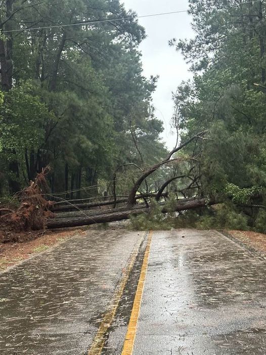


Tree blocking the Patmos Road near County Road 133. Photo by Brandy Armstrong

Downtown Saratoga. Dale Gathright, Jr. photo
The remnants of what was Hurricane Beryl pushed through southwest Arkansas Monday afternoon and evening, leaving a path of damage in the region.
The first sign something may be afoot came Monday morning from the Storm Prediction Center in Norman, OK when it issued Tornado Watch Number 514 with a 12-hour time frame. Most watches are generally 4-6 hours. Here was there reasoning:
Gradual daytime destabilization and a strong atmospheric winds associated with the northward movement of Tropical cyclone Beryl will be favorable for low-topped supercells capable of tornadoes through this afternoon and early evening. This risk will mostly be focused across east/southeast Texas and far western Louisiana this morning, but it will expand north-northeastward across additional parts of east/northeast Texas, western/northern Louisiana, and eventually southern Arkansas through late afternoon and evening.
Monday, the National Weather Service in Shreveport, LA, which has responsibility for most of southwest Arkansas, had issued 67 Tornado Warnings, by far the most in their history for a day. The largest total was December 27, 2015, with 36.
“Monday’s weather events across our region in the wake of Hurricane Beryl’s remnants are further proof that inland tropical impacts can also be quite extreme. In this case, it was the tornado threat that superseded everything else, including flash flooding. A total of 67 tornado warnings were issued across NWS Shreveport’s coverage area, easily the most in a single day event,” the weather agency said.
At times Monday evening, southwest Arkansas was under a Tornado Warning, Tornado Watch, Wind Advisory, and a Flash Flood Watch.
